Climate Change in the Oldman River Basin
Characteristics of the Oldman River Basin
The Oldman River Basin (ORB) spans approximately 23,000 square kilometres, primarily through southern Alberta. With the main headwaters of the Oldman River originating in the Rocky Mountains, the Basin extends east and encompasses areas of the Foothills, Plains, and Prairie Grasslands. Major tributaries of the Oldman River include the Livingstone River, Crowsnest and Castle Rivers, St. Mary and Waterton Rivers, as well as Willow and Pincher Creeks.
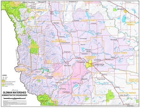
Image source: Oldman Watershed Council1.
The Basin is sparsely populated, with approximately 210,000 residents living in the ORB. Lethbridge is the largest community and agriculture is the primary industry.2 Other major economic drivers include agri-food processing, tourism, and oil and gas.3
Climate of the Oldman River Basin
To determine the climate of a region, scientists compile data from various instruments including air temperature sensors and precipitation gauges. As can be seen in the instrument record, the average amount of precipitation in the Oldman River Basin varies from 523 millimeters per year in the Rocky Mountain headwaters region to 321 millimetres per year in Prairie region to the east. The average daily maximum summer temperature is 25 degrees Celsius, and in the winter, the average daily maximum is 1 degree Celsius. The data are from the instrument record compiled by Environment Canada.
Because the instrument record is very short (only approximately 100 years), scientists use information from the natural world to gain a better understanding of the climate from thousands of years in the past. Old trees, for example, provide a record of wet and dry years because the amount of growth each year is dependent on the amount of water available to the tree.
When we look at tree ring data from the past 600 years, it shows that there was much more variability and greater climate extremes in the Oldman River Basin than can be seen in the relatively short instrument record.4 These data are important because what happened in years past will theoretically happen again. The people living and working in the ORB are familiar with droughts and with variable water supply from year to year. Because of climate change and given the range of very wet and very dry years that are reflected in the tree ring data, community members must be prepared for the possibility of even greater climate variability or extremes and an overall trend of warming.
A few examples of climate and weather extremes include events such as a multi-year long drought, many more heavy wind and hail storms throughout a summer, or high water levels in the Oldman River causing communities to flood.
Impacts of climate change on water
Southern Alberta’s semi-arid climate means that drought is already common in the region and that there are limits to available water.5 Climate projections show that more severe droughts may occur in the future due to climate change6. Compounding the tendency towards drought, air temperatures in the ORB are also projected to continue increasing in the coming decades and the average total yearly precipitation may decrease even further.3,7
Other modelling projections show that the warmer temperatures may cause mountain snow to melt during the winter and the winter snow in the mountains to completely melt much earlier in the spring.8 These changes to the snow in the mountains could result in peak flows in the river occurring earlier, and low river flows during the late summer when they are most needed. Modelling also shows that the amount of precipitation for the ORB, and therefore runoff water in the system, will likely become increasingly variable from one year to the next.9
Sharing water in the ORB
Because of the projected changing climate in the ORB, water users in the region can expect the following challenges:
- Increasing summer temperatures will likely increase the rate of evaporation from waterbodies and evapotranspiration from plants. The demand for irrigation water will therefore likely increase.10 Irrigation technology is becoming increasingly efficient and capable of delivering exactly the water that each plant needs; these advances will be particularly important for agriculture in the ORB.
- Changes to the time of year when the snow melts would change when the reservoirs are filled by snow runoff. This new timing may make it challenging for water managers to ensure there is enough water to supply municipal, irrigation and industry needs at different points in the year.
- Water managers will also have to balance the amount of water demand they expect for later in the year with the amount of rain and snow they think will come, and this may be challenging if total precipitation for each year becomes as variable as the models project.
- The wild animals and plants may need more water in warmer temperatures, and aquatic ecosystems may be impacted by changing stream flow. For example, fish that rely on higher river levels to spawn in the fall may face challenges, and species that need cold water may not thrive in warming creeks. Warm-water adapted species may become more common.
Water for the future and how you can contribute
Protective steps need to be taken now to ensure climate variabilities and extremes do not significantly impact future water users in the Basin. Some steps that can be taken include:
- Implementing flood protection measures for municipalities, farms and industrial operations, primarily for those located near Medicine Hat. This action is necessary because although the focus in the Basin is on drought, climate change increases the likelihood of extreme weather events which could lead to flooding.
- Implementing water conservation measures on farms and in communities. Increasing water efficiency, especially in irrigation systems, will ensure available water can support more agricultural during drier periods.
- Increasing the storage volume available. Climate models indicate there could potentially be a change in the timing of precipitation. It is therefore important that there are enough reservoirs available to capture and store precipitation when it is available. This storage capacity is particularly important for irrigation and for municipal supplies which tend to withdraw more water during dry periods.
Sources
- Oldman Watershed Council. (2019). Mapping the Oldman Watershed. Retrieved from https://oldmanwatershed.ca/maps
- University of Lethbridge. (2006). Current and future water issues in the Oldman River Basin of Alberta, Canada. Retrieved from http://scholar.ulethbridge.ca/sites/default/files/danjohnson/files/current_and_future_water_issues_in_the_oldman_river_basin_of_alberta_canada.pdf?m=1491417143
- Climatic Change. (2011). Potential impact of climate change on the water availability of South Saskatchewan River Basin. Retrieved from https://link.springer.com/article/10.1007/s10584-011-0221-7
- Journal of the American Water Resources Association. (2016). Adaptative Water Resource Planning in the South Saskatchewan River Basin: Use of Scenarios of Hydroclimatic Variability and Extremes. Retrieved from https://onlinelibrary.wiley.com/doi/abs/10.1111/1752-1688.12378
- Oldman Watershed Council. (2019). Management Plan for the South Saskatchewan River Basin. Retrieved from https://oldmanwatershed.ca/water-management
- WaterSMART Solutions and Alberta Innovates – Energy and Environment Solutions. (2014). South Saskatchewan River Basin Adaptation to Climate Variability Project, Phase III: Oldman and South Saskatchewan (OSSK) River Basins Summary Report. Accessed from https://albertawater.com/ssrb-adaption
- Journal of the American Water Resources Association. (2018). Projecting Canadian Prairie Runoff for 2041-2070 with North American Regional Climate Change Assessment Program (NARCCAP) Data. Retrieved from https://onlinelibrary.wiley.com/doi/abs/10.1111/1752-1688.12642
- Ibid, 2018
- Ibid, 2018
- Ibid, 2018