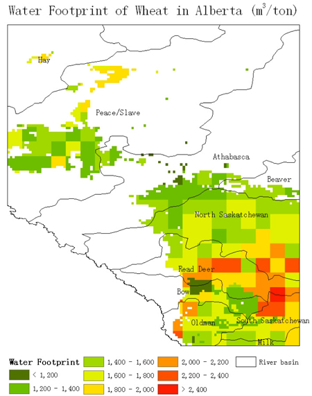
Water Footprint by Crop and Region
The water footprint of various crops was simulated with the GEPIC model. For wheat, there is a general trend that regions with high precipitation have lower water footprint. This can be seen from the relatively low water footprint in the Peace/Slave, Athabasca, and Beaver River basins, and also in the northern part of the North Saskatchewan River basin, and the relatively high water footprint in many river basins in the southern regions of the province.
In the dry regions in the south, the water footprint is relatively lower in the Irrigation Districts. This is because irrigation is applied when insufficient rainfall is available. In general, irrigated wheat can achieve high crop yields, as well as low water footprint. The lowest water footprint of wheat occurs in the Western Irrigation District.
In general, the rules hold also for barley and canola: low water footprint occurs normally in regions with high precipitation or in the irrigation districts. In general, when comparing the three crops, it seems that: in general
- Barley has the lowest Water Footprint
- Canola has the highest Water Footprint
- Wheat has a Water Footprint between barley and canola

