The South Saskatchewan River Operational Model (SSROM)
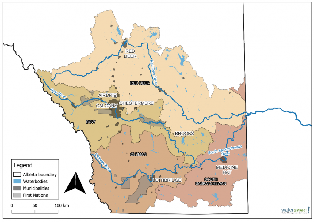
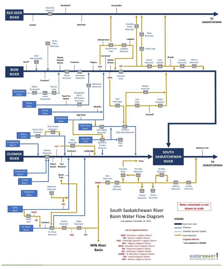
The headwaters of the South Saskatchewan River Basin (SSRB) are located on the Eastern Slopes of the Rocky Mountains of Alberta. The SSRB in Alberta is part of the Saskatchewan River Basin that covers most of southern Saskatchewan and central Manitoba. In Alberta, the SSRB includes the Bow, Red Deer, Old Man, and South Saskatchewan rivers; these rivers provide water to the cities of Calgary, Red Deer, Lethbridge, and Medicine Hat as well as all 11 of the province’s irrigation districts. Much of the water that is consumed in the SSRB is used in irrigation districts and agriculture; the agri-food industry provides economic diversification within the region.
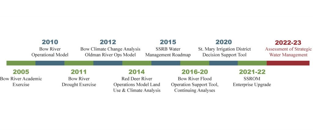
SSROM History
The South Saskatchewan River Operational Model (SSROM) is a result of over 13 years of collaborative work led by WaterSMART Solutions Ltd. Modelling work, using the Operation Analysis and Simulation of Integrated Systems (OASIS) platform, was initiated as part of an academic exercise looking at the Bow River. This work has grown into a collaborative water management approach that has expanded across the Bow River to includes the Red Deer and Oldman River basins. Throughout the 13 years of collaborative work a number of projects have been executed to guide water management in the SSRB, seen in Figure 3.