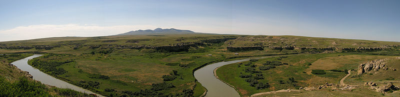
Hydrological Modelling of Alberta – Milk River Basin
The smallest of the province’s major river basins encompassing an area of about 6,500 km2. The river is a northern part of the Missouri-Mississippi River Basin. The Milk River enters Alberta from Montana, flows eastward through the southern portion of the province prior to looping back to Montana, and it eventually drains into the Mississippi River. Mean annual flows entering Alberta are 106 million m3 and leaving Alberta are 167 million m3.
The Milk Basin is about 11,860 km2 in area, which represents 2% of Alberta.
In 2001, the Basin had a population of only 11,500 people, or 0.4% of the provincial population, resulting in a population density of 1.0 person per square kilometer. The Milk Basin is comprised of all or parts of the counties of Cardston, Forty Mile No. 8. Lethbridge, and Cypress. Major urban centres include the towns of Milk River and Raymond and the villages of Coutts, Stirling and Warner. There are no Aboriginal Reserves or Métis Settlements within the Milk River Basin.
An overview of surface and groundwater allocations shows that agriculture, including registrations, accounts for 88% of total allocations, which totaled 58,440 dam3 in 2005. The other 18% of water allocations consisted mainly of other and municipal uses.