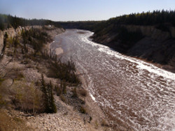
Hydrological Modelling of Alberta – Hay River Basin
The Hay River is located in the northwest portion of the province and originates in British Columbia’s Rocky Mountains. It comprises part of the Mackenzie River system, which drains eventually into the Arctic Ocean.
The Hay Basin, at about 40,000 km2, occupies approximately 6% of Alberta by area. The basin has a drainage area of 47,900 km2 at the Alberta-Northwest Territories border. The mean annual natural river discharge of the Hay River is 3,600,000 dam3.
In 2001, the basin had a population of 7,015 people, or 0.2% of the provincial population. The basin had a population density of just 0.2 people per square kilometre. The Hay Basin includes all or parts of three rural or regional municipalities and contains one urban municipality and two Aboriginal settlements.
An overview of existing surface and groundwater allocations shows that the petroleum sector accounts for 75% of allocations (4,893 dam3) and the other sector accounts for 15% of total allocations (960 dam3) in 2005. The municipal sector accounts for most of the remaining allocations with 686 dam3 (10%). Total allocations in the basin in 2005 totalled 6,598 dam3.

