Athabasca River Basin
The Athabasca River stretches 1,500 km from the Columbia Icefield in Jasper National Park to the northeastern corner of Alberta and into western Saskatchewan. Characterized by diverse regions, the Athabasca River Basin (ARB) is unique in natural resources, ecology, climate, and development. The Athabasca River connects these regions as it flows through the river network, creating the ARB.
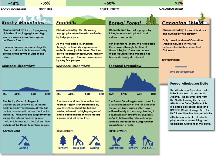
The Natural Regions in the ARB include the Rocky Mountains, Foothills, Boreal Forest, and Canadian Shield. Over half of the ARB is part of the Boreal Forest region, while only <1% is part of the Canadian Shield region.
Climate Change
Potential changes in future climate poses a challenge for water management in the ARB as snowmelt timing is expected to shift substantially in the future, resulting in longer snow-free periods. Other possible outcomes could include:
- Higher spring flows
- Lower summer flows
- Higher glacial contribution (medium-term)
- Lower glacial contribution (long-term)
Overall, the hydrological regime of the ARB is likely to be very different from the last several decades. However, thoughtful water management planning can help ensure environmental, social, cultural, and economic effects of changes in climate are not exacerbated by human influence.
Water Management
The ARB has historically attracted settlement and development and represents a rich and diverse ecological heritage. The natural attributes are important to the region’s identity, which has driven the development of policy and legislation to provide the broader context and necessary frameworks for water management in the basin.