PUBLISHED: 14 August 2012
Hydrological Modelling of Alberta – Water Availability
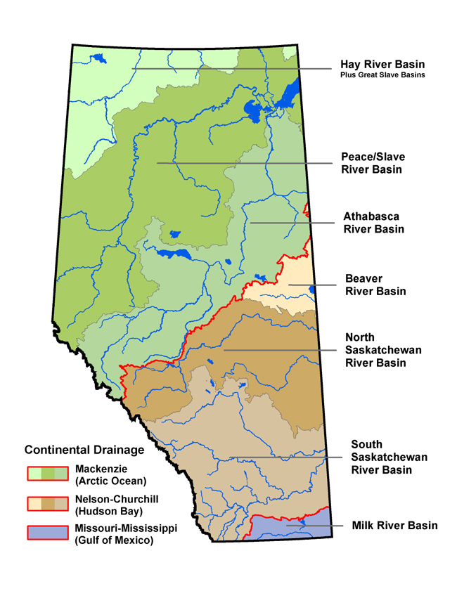
The spatial and temporal variations of water resources across the province has caused regions of scarcity. In general, the northern regions of Alberta are the wettest. The majority of Alberta’s water is generated in the Peace River system and flows northward through the Slave River. In contrast, in the south, where water use is highest, the least amount of water is available.
There are three main reasons for this variation in stream flow:
- The size of drainage basin (e.g., the Peace River Basin encompasses nearly 44% of total area of Alberta)
- The location of headwater systems (the mountains / foothills receive more precipitation than the plains)
- The variation in climate (temperature is higher and evaporation greater in southeastern Alberta than in northern and western regions)
There are ten major river basins in Alberta, including:
- Hay River Basin
- Peace/Slave River Basin
- Athabasca River Basin
- Beaver River Basin
- North Saskatchewan River Basin
- Milk River Basin
- South Saskatchewan River Basin including:
- Red Deer River sub-basin
- Bow River sub-basin
- Oldman River sub-basin
- South Saskatchewan River sub-basin